Enregistrez gratuitement cette image
en 800 pixels pour usage maquette
(click droit, Enregistrer l'image sous...)
|
|
Réf : T01191
Thème :
Terre vue de l'espace - Forêts (124 images)
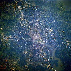
Titre : Washington, District of Columbia, U.S.A. August 1989
Description : (La description de cette image n'existe qu'en anglais)
The legislative, administrative, and judicial center of the United States, Washington, DC, can be seen in this east-northeast-looking, low-oblique photograph. Situated on the banks of the Potomac and Anacostia Rivers, the District of Columbia covers 69 square miles (179 square kilometers). The population of metropolitan Washington, which includes suburbs in both Maryland and Virginia, is the eighth largest in the United States (3.9 million). The population of the District of Columbia has decreased drastically since the mid-1960s as the population moved outward into the suburbs. The Federal Government and tourism are the major sources of employment in the city. Numerous military bases are scattered throughout the metropolitan area. Major transportation routes and bridges that cross the Potomac and Anacostia Rivers can be seen in the photograph. Visible airfields are Andrews Air Force Base east of the city and Dulles International Airport west of the city in the lower left portion of the image. The Potomac River crosses a series of small escarpments northwest of Washington, particularly at Great Falls, Maryland. As the river enters the Washington area from the northwest, it broadens, becomes a tidal estuary, and continues to flow southeastward to Chesapeake Bay.
|
|

